I’ve walked the hallowed grounds of this nation for decades, seen the pristine mansions, the recreated villages, the bronze plaques narrating heroic deeds. And while there’s certainly value in these traditional historical experiences, an honest traveler eventually feels the gnawing question: *Whose stories aren’t we hearing?* Whose footsteps have been erased from the manicured lawns and whose voices were silenced by the grand narratives? This isn't merely an academic musing; it’s a profound deficit in our collective memory, one a groundbreaking new digital guide aims to rectify for the upcoming 250th anniversary of the Revolution.
Beyond the Grand Façades: Reclaiming the Unseen Tapestry of History
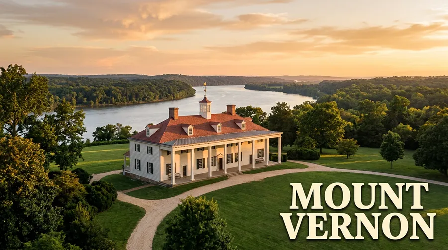
Most of us, when we picture Revolutionary War sites, conjure images of Mount Vernon or Colonial Williamsburg – places where history is literally built to be seen. But what about the stories that never earned a prominent structure, whose locations have been swallowed by time or deliberately obscured? Consider the enslaved women who ran vast households, the Indigenous nations whose lands became battlegrounds, or the free African Americans who carved out lives in the shadow of bondage. Their contributions, their struggles, and their very presence were foundational to the nascent United States, yet their histories remain largely unmarked, whispering from dusty archives rather than shouting from roadside markers.
The problem is systemic: traditional historical preservation often prioritizes the tangible, the monumental, the stories of power and privilege. While these sites are undoubtedly important, they present an incomplete picture. For too long, the narratives of women, Indigenous peoples, and African Americans have been marginalized, often seen as footnotes rather than central threads in the fabric of the past. This isn't just about adding new facts; it's about fundamentally shifting our understanding of the period, acknowledging the full human drama that unfolded.
Mapping the Past, Layer by Layer: The Digital Detective Work
How does one find history that was never meant to be found? It’s a monumental task, but this new initiative leverages cutting-edge technology to achieve it. Imagine a team of historical detectives poring over eighteenth-century
The real magic, however, comes from the archival deep-dive. Researchers are sifting through local manuscript collections, unearthing forgotten personal letters, business records, wills, and crucially,
Giving Voice to the Echoes: Why Community Is the Real Cornerstone
You can map a thousand historical sites, but without the human stories, they remain mere coordinates. This is where the project truly distinguishes itself: it recognizes that the most profound insights often lie not in written records alone, but in the living memory of descendant communities. Partnering with tribal nations, African American descendant groups, and local women’s history projects, the initiative is actively sourcing recorded testimonies. These aren't just interviews; they’re vital threads connecting the past to the present, ensuring that sensitive narratives are shared with respect and appropriate context.
Think about it: who better to tell the story of an Indigenous war council than the descendants of those who participated? Who can truly convey the daily life and quiet resistance of an enslaved artisan better than their great-great-grandchildren, who may still carry fragments of those stories? This collaborative approach challenges the conventional academic model, where historians often interpret from a distance. Here, the community becomes co-curator, injecting authenticity and emotional resonance that no textbook could ever replicate. It also allows for the collection of new oral histories directly through the app, creating a living, breathing archive that expands with every visitor's reflection.
Stepping into the Revolution: Augmented Reality's Game-Changing Promise
So, you’ve got the maps, the documents, the oral histories – but how do you experience a site that no longer visibly exists? Enter augmented reality (AR). This isn't just a tech gimmick; it's a revolutionary tool for historical interpretation. Imagine standing in an unassuming field in rural Virginia, opening your phone, and through the screen, seeing a virtual reconstruction of a midwife's cabin materialize before your eyes. You’re not just reading about Mary, the midwife; a holographic narrator, perhaps an actor portraying her based on historical accounts, describes her role in tending to both Patriot and Loyalist soldiers, blurring the lines of allegiance in a very human way.
The AR experience goes deeper. Pinch-zoom gestures might reveal facsimiles of Mary’s actual ledger entries, showing her fees and patients. Spatial audio could play the reflections of her community’s descendants, fading in as you approach where her well once stood. You can toggle through different temporal layers – seeing the land before the Revolution, during wartime encampments, and then post-1783, witnessing the profound changes wrought by the conflict. This immersive, interactive approach transforms an invisible landscape into a vibrant historical stage, making the intangible tangible and bringing a visceral sense of presence to stories long absent from traditional historical tours.
Charting Your Own Course: What to Expect from the 250th Anniversary Experience
This isn't just a vision for the future; it's an actionable plan rolling out for the nation's 250th anniversary. The initial prototype and data assembly phase are expected to take about six months, focusing on a few pilot sites in three colonies. Following that, a more extensive content expansion and community review phase will span approximately 12 months, aiming to cover all thirteen original colonies and integrate feedback from stakeholder groups. The public launch is strategically planned for three months before the 250th, giving visitors ample time to download and explore. So, if you’re planning a trip to the East Coast around 2025, prepare for a new kind of exploration.
What should you expect? Firstly, come prepared to walk, often in places that aren't paved paths. These are unmarked sites, after all, some in what feels like wilderness, others tucked away in unassuming neighborhoods. Secondly, be ready to engage your mind and your senses in new ways. This isn't a passive museum visit. The experience will likely involve a fair bit of independent exploration, guided by your device, and a willingness to confront nuanced, sometimes uncomfortable, truths about our past. Costs, if any, will primarily be for the app download itself, with the focus on accessibility to these critical histories. You might find yourself arriving early on a weekday to avoid potential crowds at particularly significant sites once the word gets out.
Finally, anticipate a profoundly personal journey. This app isn't just about delivering facts; it’s about fostering empathy and understanding. You'll hear the voices of individuals who faced immense challenges, who contributed to the birth of a nation from perspectives rarely acknowledged. It's an opportunity to truly redefine your relationship with American history, moving beyond the well-trodden paths to discover the hidden rivers that shaped our collective identity. This project promises to be a powerful, essential component of how we understand the Revolution, ensuring that for the 250th anniversary, all stories finally have their place.