There's a certain gravitas to standing on ground consecrated by history, particularly at America's old forts. For decades, our experience of these sites has largely been dictated by crumbling walls, mounted plaques, and the occasional reenactment. We've walked the battlements, peered into barracks, and perhaps imagined the lives lived there, often through a singular, dominant lens. But what if those walls, those earthworks, and even the very air around them could speak anew, not just in echoes of generals and soldiers, but in the voices of everyone who shaped their stories? In 2025, an astonishing transformation is unfolding at sites like Fort Ticonderoga, Fort Sumter, and Fort Laramie, proving that the deepest insights often emerge when we stop merely looking at the past and start actively listening to it, aided by some truly remarkable technological innovations.
I’ve explored my fair share of historic fortifications, from colonial bastions hugging the Atlantic to remote outposts guarding westward expansion routes. My biggest takeaway? The real history isn't always the one immediately visible, or the one etched into bronze markers. It’s often buried, overlooked, or deliberately obscured. That's precisely why the surge of new technologies—LiDAR scanning, augmented reality (AR), virtual reality (VR), and AI-driven narrative platforms—at these three iconic forts isn't just a fancy gimmick. It’s a radical re-imagining of preservation and interpretation, finally bringing to light the indispensable contributions of Indigenous peoples, enslaved individuals, and women, whose narratives have historically been relegated to footnotes, if they appeared at all. Prepare to have your understanding of American military history, and indeed American identity, profoundly expanded.
What LiDAR Reveals Beneath the Surface at Fort Ticonderoga
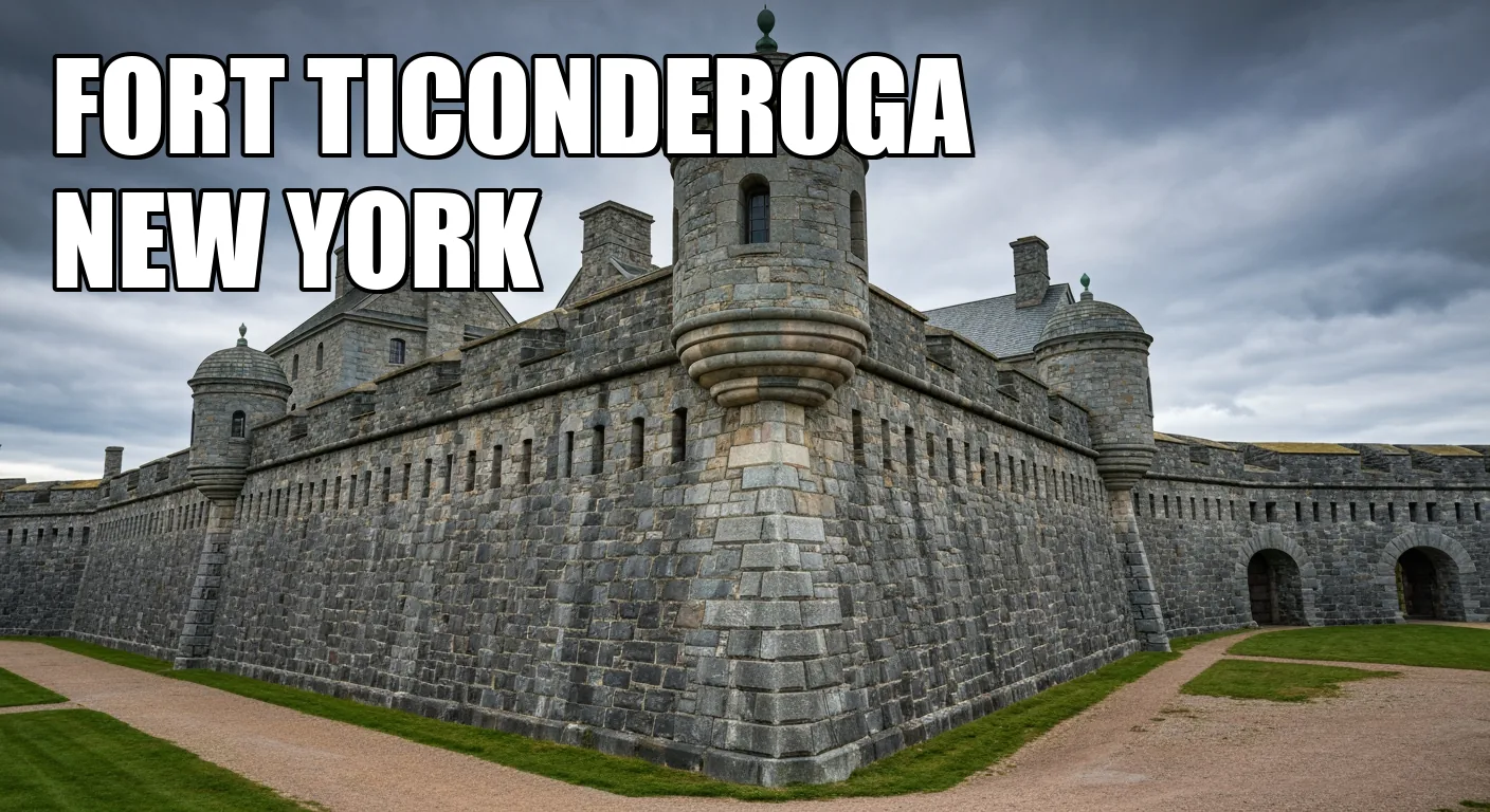
My first stop on this technological tour of historic strongholds takes us to upstate New York, where Fort Ticonderoga, a linchpin of both French & Indian and Revolutionary Wars, is implementing its "REAL TIME REVOLUTION" program. For years, I thought I understood Ticonderoga: the epic clashes, Ethan Allen’s audacious capture, the strategic importance of Lake Champlain. Yet, what I’m finding now, guided by new research and cutting-edge tools, suggests we’ve only ever seen half the story. The fort has collaborated with Vermont's state archaeologist, Jess Robinson, to deploy aerial LiDAR – that’s Light Detection and Ranging, a remote sensing method that uses pulsed laser to measure distances and create detailed 3D maps of the landscape. What this has done, quite simply, is peel back centuries of forest growth and soil accumulation, revealing unseen earthworks, trenches, and even road traces from both the French (who called it Fort Carillon) and, more significantly, Indigenous landscape modifications that predated European arrival. It’s like finding a hidden blueprint written in the earth itself, confirming that this land was shaped and understood by many hands long before European cannons ever roared.
The practical implications for visitors are profound. You won’t just see the reconstructed stone walls anymore; the LiDAR-derived maps are guiding how the park interprets its pre-colonial and early colonial features, essentially giving visual context to a much longer history. While you might not spot the laser scanner overhead during your visit, the fruits of its labor will manifest in new interpretive signs, walking tours, and perhaps even early AR overlays on your mobile device, showing you exactly where those ancient earthworks lie beneath your feet. To truly appreciate this, consider visiting in the quieter shoulder seasons—late April or early October—when the foliage is less dense, offering a clearer (metaphorical) view of the land's contours, and the crowds from summer tour buses are absent. Expect to spend a solid half-day, if not more, to fully absorb the traditional narratives and then delve into these newly unveiled layers. Admission typically runs around $24 for adults, but parking is usually free and plentiful.
Engaging with Unheard Voices Through AI at Fort Sumter
Shifting gears entirely, both geographically and historically, we land in Charleston, South Carolina, home to Fort Sumter, where the first shots of the Civil War ignited a nation. Unlike Ticonderoga's sprawling landscape, Sumter is an island fortress, a stark monument to a nation divided. My initial visits here focused, as most do, on the dramatic siege, the cannons, and the sheer resilience of its defenders. But the National Historical Park, alongside partners like the American Battlefield Trust, is now pushing the narrative far beyond military strategy, using AI and digital archives to highlight stories that have long been submerged. LiDAR, for instance, isn't just for archaeology here; the US Army Corps and NPS teams are using high-definition terrestrial LiDAR to meticulously monitor the fort’s fabric and seawall erosion. This isn't just about preservation for preservation's sake; it's a stark reminder that the very masonry you touch was often built by the forced labor of convicts and enslaved people, a challenging truth that the technology helps us confront more directly.
It’s the AI-powered virtual tours and augmented audio layers, however, that truly redefine the visitor experience. Imagine taking a 360° virtual tour on your device, and as you virtually move through the fort, AI chatbots populate tour points with stories of Gullah-Geechee dock workers—descendants of enslaved West Africans who developed a unique creole language and culture in the Lowcountry—who supplied the very building materials to the fort. These aren't generic voiceovers; AI-generated Gullah-Geechee and Cherokee voice actors present oral histories at precise tour waypoints, giving voice to those whose labor was foundational yet unacknowledged. Then there's the mobile AR app, which overlays Union siege diagrams and even Confederate Salkehatchie band camp scenes onto the fort’s ruins, starkly reminding us of Indigenous displacement concurrent with the siege. This dual-layered experience, blending the physical ruin with digital reconstructions and poignant testimony, forces a deeper understanding of the human cost and the intertwined narratives of conflict, forced labor, and cultural erasure. To best experience this, I’d suggest planning for an early morning ferry ride out to the fort, especially during the spring (March-May) or fall (September-November) to avoid the intense summer heat and crowds. Ferry tickets (usually around $30-35 for adults, including park admission) must be purchased in advance, and allow a solid 2.5-3 hours for the round trip and exploration. Don't expect to just wander aimlessly; engage with the apps to get the full, revolutionary experience.
Who Built the West? Fort Laramie's Digital Reckoning
My final destination is Fort Laramie in Wyoming, a vital hub during the Westward Expansion, famous for its role in the fur trade, overland trails, and treaty negotiations with Plains tribes. For too long, the narrative here, like many western sites, centered on explorers, soldiers, and white pioneers. What was often missed were the complex, nuanced interactions with the many Indigenous nations—Lakota, Cheyenne, Arapaho—and the crucial, often unheralded, roles of women and Métis traders. But Fort Laramie National Historic Site is using a potent blend of 3D scanning and digital storytelling to disrupt that conventional wisdom.
You might not realize it as you walk the historic grounds, but the USGS (United States Geological Survey) used Unmanned Aircraft Systems to collect airborne LiDAR back in 2017. This wasn't just for pretty pictures; it helped model flood risk and, crucially, revealed former trail alignments and Indigenous campsites hidden beneath years of vegetation. Similarly, terrestrial laser scanning by CyArk captured intricate details of officer row interiors and parade ground layouts, creating precise point-cloud models for virtual preservation. These technologies are giving archaeologists and historians a granular understanding of the land and structures that was previously impossible, showing us exactly where different groups lived and interacted.
The real magic for the visitor, however, unfolds through the fort's new AI-driven story maps and virtual reality interpretive tours. Forget dry historical timelines; these interactive web platforms use AI to curate multi-threaded narratives. You can delve into the profiles of Métis traders—people of mixed Indigenous and European ancestry who played a pivotal role as cultural brokers and economic drivers on the frontier—and Cheyenne negotiators involved in the pivotal 1868 Fort Laramie Treaty. Accounts of women laundresses and traders, whose contributions to the supply networks and daily life of the fort were long omitted from official records, are finally spotlighted. Imagine stepping into a VR kiosk that reconstructs 1849 emigrant encampments, where AI-voiced diaries of a Lakota elder and a German immigrant woman allow you to experience the journey from radically different, yet equally authentic, perspectives. It's an embodied engagement with history that transcends simple observation, making the abstract personal and immediate. Plan your visit for early morning or late afternoon during spring (late April to early June) or fall (September-October) to catch the best light for photography and avoid the summer heat, which can be intense on the open prairie. Admission is typically $20 per vehicle, covering all occupants, and the site offers ample parking. Give yourself at least 3-4 hours to truly engage with both the physical grounds and these enriching digital experiences.
Challenging the Homogenized Past: A New Era for Forts
What these three forts collectively demonstrate is a profound shift in how we engage with our past. The technologies aren't simply augmenting existing narratives; they’re actively unearthing and amplifying suppressed voices, creating a much richer, more honest tapestry of American history. For too long, the stories of marginalized groups were treated as footnotes or sidebars, if they were acknowledged at all. Now, thanks to LiDAR revealing Indigenous land engineering, AI platforms delivering personalized narratives from enslaved individuals and Métis traders, and AR/VR immersing us in the daily lives of women camp followers and Lakota elders, these voices are taking center stage. The "hero narratives" of generals and treaties are no longer the exclusive story; they are now interwoven with the essential, often difficult, truths of those who built, labored, suffered, and survived alongside them.
This isn't just about 'updating' a museum exhibit; it's about fundamentally altering our understanding of place and identity. As a seasoned traveler, I've seen countless attempts to modernize historical interpretation, but few have felt as genuinely transformative as this. You might arrive expecting another conventional fort tour, but you'll leave with a powerful, often surprising, sense of connection to a past that’s far more complex and inclusive than any textbook might suggest. So, when planning your 2025 travels, don't just visit these forts; prepare to embark on a journey that will challenge your assumptions and, hopefully, inspire you to listen more deeply to the echoes of history, wherever you may roam.